 NERC Data Catalogue Service
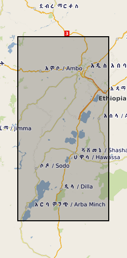
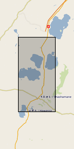
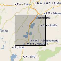
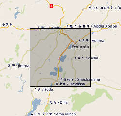
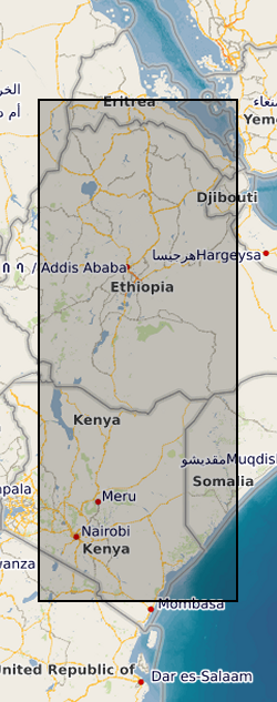
Rift valleys
Type of resources
Topics
Keywords
Contact for the resource
Provided by
Years
Formats
Representation types
Update frequencies
-
This data set contains a set of 226 unwrapped, geocoded interferograms derived from InSAR scenes processed over Corbetti Volcano, Ethiopia. The data were assembled from multiple sensors and processed using either the ICSE or GAMMA software package. The images presented here are generally not the same size as the raw InSAR images but instead are cropped to the extents of the volcano and its immediate environs.
-

This data set contains daily position solutions for GPS stations deployed on Corbetti and Aluto volcano, Ethiopia. The results for Aluto were originally published in "Seasonal patterns of seismicity and deformation at the Alutu geothermal reservoir, Ethiopia, induced by hydrological loading", Birhanu et. al. (2018). Corbetti results were partially published in "Sustained Uplift at a Continental Rift Caldera", Lloyd et al. (2018).
-
The RiftVolc GPS network was comprised of a total of 10 continuously recording stations deployed on Aluto and Corbetti Volcanoes between 2012 to present. At least 9 stations were recording data simultaneously except in 2012, 2016 and 2017 where 1, 8 and 5 stations were in operation respectively. Full details on station location and operation periods are provided in the attached README file.
-
This data set includes the original time series collected with broadband and long-period MT instruments during two field seasons in 2016 and 2017 by a team of researchers from the University of Edinburgh, UK and the Institute for Geophysics, Space Science and Astronomy at Addis Ababa university, Ethiopia. For the magnetotelluric stations, processed transfer functions are included in the edi file format. The time series data is provided both in the original raw data format and an ascii version. We provide information on the locations and the processing and include the necessary instrument response functions and metadata to reproduce our results from the raw data. For the TEM recordings, site coordinates and raw data are included in the original format.
-
Glass major element geochemical data on Late Quaternary tephra deposits from the Main Ethiopian Rift volcanoes. These data were acquired using Electron Microprobe Analysis, and secondary standard data (MPI-DING glasses) are also included. All samples were given a unique name related to the outcrop from which they were obtained. Outcrops are named "MER" followed by a 3-digit number (e.g. MER153). Samples from a given outcrops are given the same name, followed by a letter (e.g. MER153A). Outcrop localities, with GPS coordinates (Lat Long WGS84) and brief description of the geology are also included. These data are published as Supplementary Files to a paper published in Journal of Volcanology and Geothermal Research: Fontijn et al (2018), https://doi.org/10.1016/j.jvolgeores.2018.02.001.
-
This data set contains a set of 20,740 unwrapped, geocoded interferograms derived from Sentinel-1 InSAR scenes processed over 63 volcanoes within the East African Rift system. A full description of the dataset is provided in the accompanying READMe file. This data set was first published in Albino, F. & Biggs, J. (2020). Magmatic processes in the east African rift system: Insights from a 2015-2020 Sentinel-1 InSAR survey, Geochemistry, Geophysics, Geosystems.
-
The RiftVolc microgravity network was comprised of a total of 4 benchmarks including a reference benchmark. Benchmark locations, observed gravity changes, dg14 -16, from 2014-2016, corresponding vertical deformation, Uz, free-air effect, and resultant residual gravity changes gr of the microgravity and GNSS network at Corbetti.
-
This data set contains 119 unwrapped and geocoded inteferograms derived from Cosmo-SkyMed (CSK) SAR scenes aquired over the Northen Main Ethiopian Rift between June 2014 and December 2015. This data set also contains displacement time series derived from processed CSK and Sentinel-1 inteferograms at the locations specified in the accompanying README files